THE FLEET/FOUR SYSTEMS/STAGED HONESTLY
Aerial, deployable, downhole, and the record they write.
FIXED WING VTOL/VAQUERO/STATUS: IN FLIGHT TEST
Vaquero
Vaquero takes off vertically from a caliche pad and transitions to wing-borne flight for a full working day. It returns with an orthomosaic, a thermal pass, and a track of everything it saw.
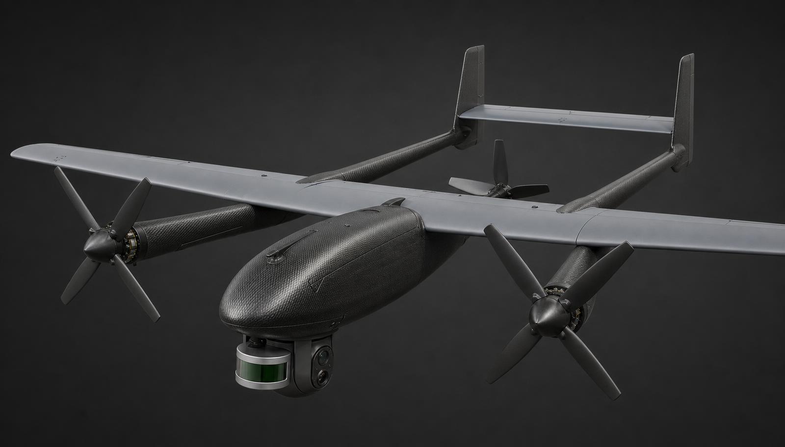
SPECIFICATION
- CONFIGURATION
- Fixed wing VTOL, 4 lift + 1 pusher
- WINGSPAN
- 3.5 m
- MTOW
- 24 kg
- TARGET ENDURANCE
- 10 hr (bench + flight test ongoing)
- CRUISE
- 22 m/s
- PAYLOAD
- Gimballed optical + LWIR turret, 2.4 kg
- OPERATION
- Part 107; building to Part 108 DAA + conspicuity
- ORIGIN
- Designed and assembled in the United States
WHAT IT’S FOR
- 01Weekly full-lease imagery across scattered pads in Reeves County instead of a quarterly contract flight.
- 02Thermal screening of tank batteries and separators over a whole Delaware Basin block in a single sortie.
- 03Locating undocumented wellbores on ranch acreage in the Anadarko where no plat shows them.
WHAT IT ISN’T
Vaquero is not a survey-grade photogrammetry replacement for lidar-based reserves work. It is for frequency — seeing your field weekly instead of quarterly.
OPEN VAQUERO PAGE →HEAVY OCTOCOPTER FLIGHT + TRAILER/REMUDA / POINTER/STATUS: IN DEVELOPMENT
Remuda + Pointer
Remuda is a gas-hybrid heavy octocopter built to work all day in wind and dust. Four of them ride a single towed trailer, launch together from the deck, split a lease between them along the shortest non-overlapping routes, and come close in on each wellhead to sniff for leaks and photograph what they find. Pointer is the sensor head each aircraft carries.
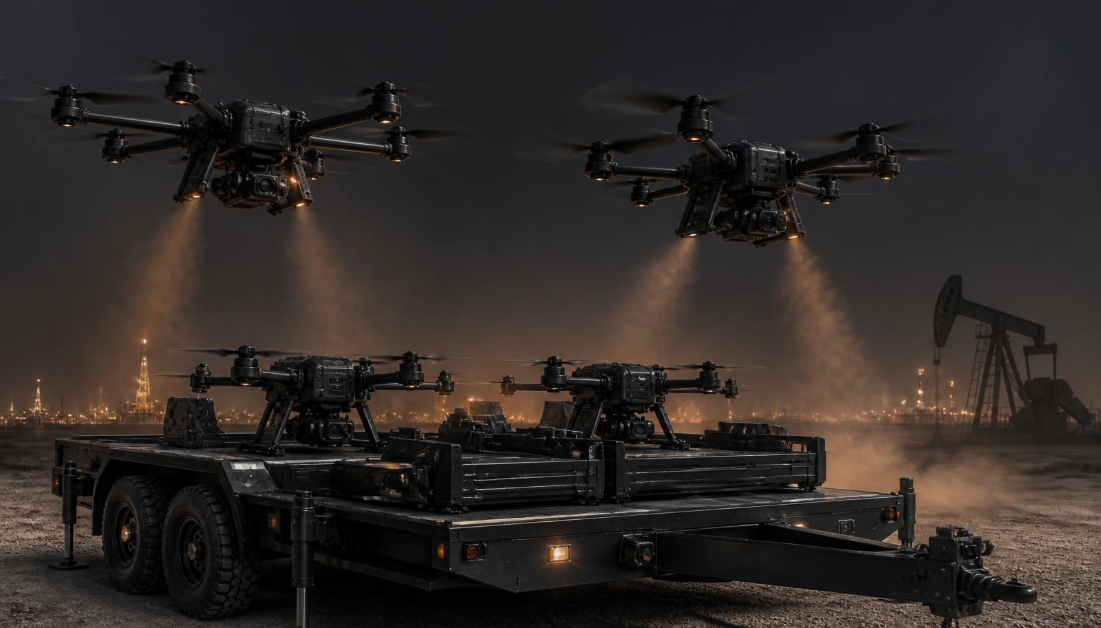
SPECIFICATION
- CONFIGURATION
- Coaxial octocopter, 8 rotors on 4 folding arms
- SPAN
- 2.2 m, folds to 0.9 m for the trailer rack
- POWER
- Gasoline generator hybrid, battery buffer for lift
- TARGET ENDURANCE
- 3 hr hover-capable (bench + flight test ongoing)
- LAUNCH
- Towed 4-bay trailer, all four airborne inside 5 min
- POINTER SENSORS
- Laser CH4, H2S, VOC, LWIR, high-res optical
- AUTONOMY
- Shared route split, obstacle avoidance, radar + lidar
- WEATHER
- Design target 25 kt sustained wind, sealed to IP55
- MATURITY
- Bench prototypes; no field deployment yet
- ORIGIN
- Designed and assembled in the United States
WHAT IT’S FOR
- 01One truck parking on a section line and clearing every wellhead on the block before lunch.
- 02Close-in methane and H2S sniffs at the stuffing box and valve stack, not a pass at altitude.
- 03A dated photo set and gas reading for every well in an acquired package, without a windshield crew.
WHAT IT ISN’T
Remuda is not a delivery drone and not a fixed monitoring installation. It is a crew of aircraft that covers ground a truck cannot, and it does not replace a technician with a wrench.
OPEN REMUDA + POINTER PAGE →DOWNHOLE INSPECTION VEHICLE/SOUNDER/STATUS: IN DEVELOPMENT
Sounder
Sounder is an untethered downhole inspection vehicle — an instrument package that descends the wellbore and returns casing condition, pressure and temperature without a logging truck. Gen 1 is a gravity-deployed tool on a life line.
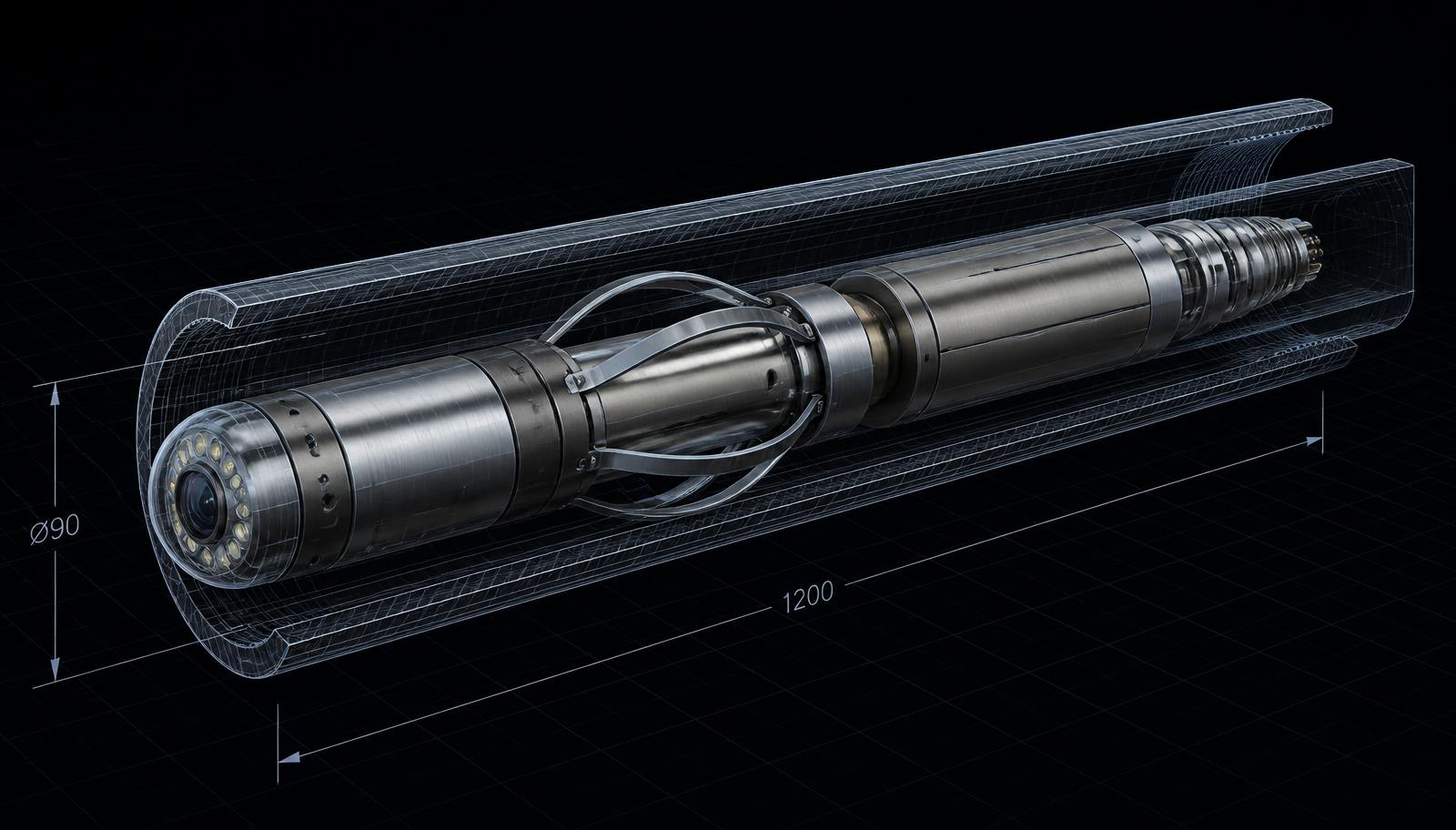
SPECIFICATION
- FORM
- Cylindrical tool, segmented body
- DIAMETER
- 90 mm
- LENGTH
- 1.2 m
- DEPLOYMENT
- Gen 1: gravity-deployed on life line
- DATA
- Casing condition, pressure, temperature, depth stamp
- TARGET RATING
- Design target 10,000 psi / 150 °C
- MATURITY
- Pressure-vessel design; no downhole runs yet
- ORIGIN
- Designed and assembled in the United States
WHAT IT’S FOR
- 01Screening four hundred stripper wells to find the twelve with a real integrity problem.
- 02Pre-plugging condition checks on wells covered by SB 1150 inactive-well requirements.
- 03Confirming what is actually downhole in an acquired package before the first workover budget is written.
WHAT IT ISN’T
Sounder is not a high-resolution acoustic imaging service and does not compete with premium intervention tooling. Those tools answer what exactly is wrong with one expensive well. Sounder answers whether anything is wrong with any of four hundred cheap ones.
OPEN SOUNDER PAGE →DATA LAYER/PLAT/STATUS: FLYING
Plat
Plat ingests orthomosaics, thermal frames, point clouds and pod telemetry and files them against wells and pads rather than against flights. Change over time is the product; a single survey is just the first row.
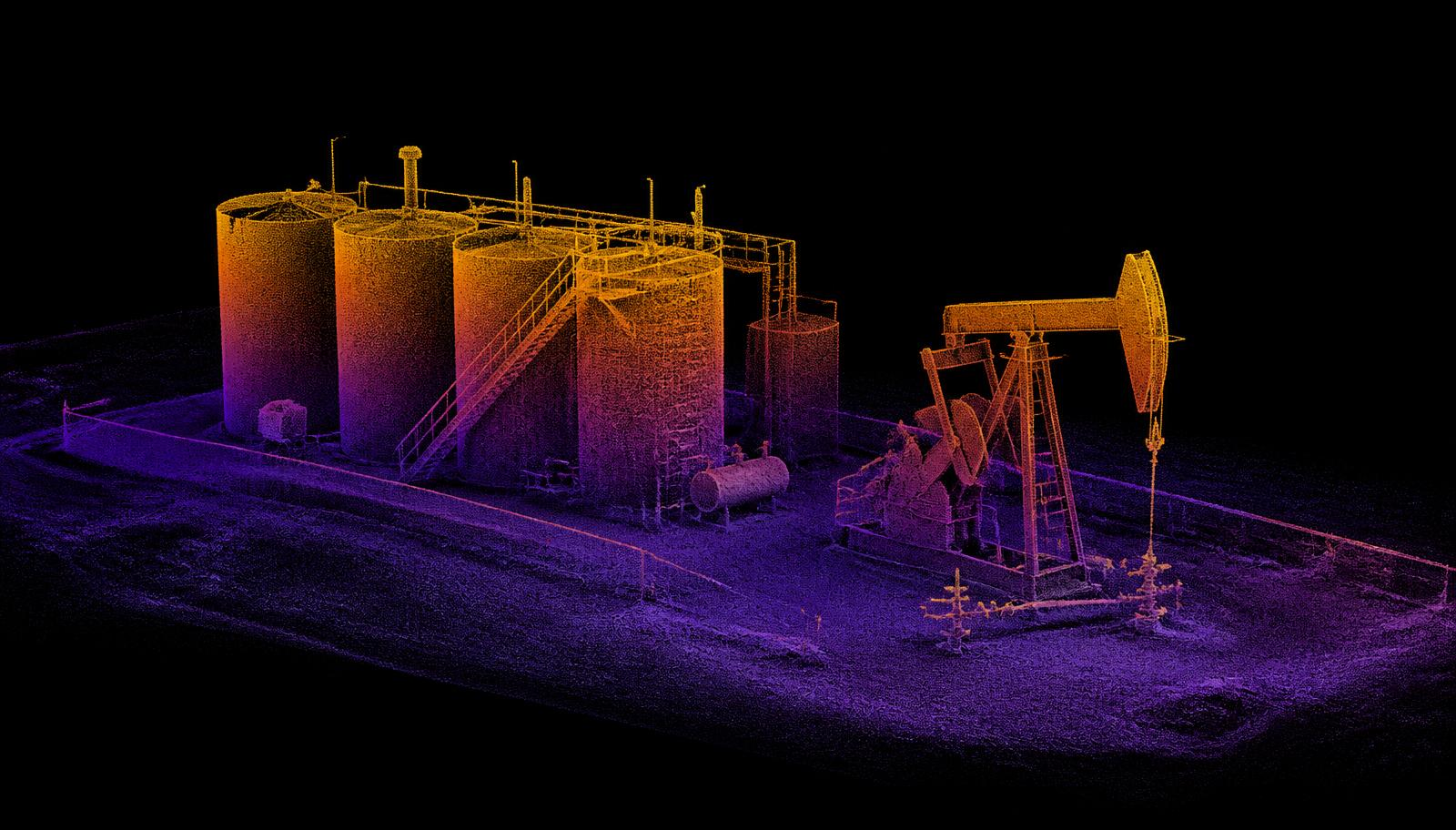
SPECIFICATION
- INPUTS
- Orthomosaic, LWIR / OGI, point cloud, pod telemetry
- INDEXING
- By well and pad, not by flight
- CHANGE DETECTION
- Pass-over-pass differencing
- EXPORT
- GeoTIFF, LAS, CSV, API
- ACCESS
- Operator-scoped; your data stays yours
- HOSTING
- US regions only
- STATUS
- In use on internal test flights
- ORIGIN
- Built in the United States
WHAT IT’S FOR
- 01Handing an EHS lead a dated record of a tank hatch instead of a folder of photographs.
- 02Showing a landowner what changed on their pasture between two passes.
- 03Ranking four hundred wells by what actually needs a truck this month.
WHAT IT ISN’T
Plat is not a GIS replacement and not a reserves model. It is the file cabinet for measurement.
OPEN PLAT PAGE →RENDERS ARE ENGINEERING CONCEPTS. FIELD OUTPUT SHOWN AS SIMULATED IS LABELLED AS SUCH.